

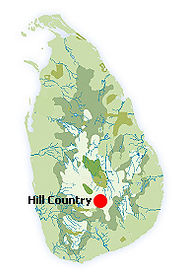
HILL COUNTRY
Nuwaraeliya
Discovered and developed as a hill sort for its collection of forests and meadows and the salubrious climate Nuwaraeliya became a quaintly cloned English village. The red roofed Post Office, the granite edifice of the Hill Club, an 18 hole Golf Course, A picturesque lake and a Race Course made it a surreal Surrey village with many famous attractions and hidden treasures which are away from the tourist beaten track. They await your discovery.
Nuwaraeliya is conveniently covered under the shadows of the tallest mountains of the island with all attractions of scenic beauty, adventure and curious conundrums of nature are within easy reach.. Hiking and Trekking are not possibilities. They are opportunities not to be missed. Nuwaraeliya is the convenient base to explore the curious conundrums of nature found in the central hills of Sri Lanka. It has a unique arrangement of plateaus, ridges intermontane basins and valleys. Its four montain ranges are Pidurutalagala2, 524-metre (8,281 ft) Krigalpoththa (2,388 m (7,835 ft) Thotupola Kanda 2357m 7,737ft) Adams peak (2,243 metres7,359 ft) Namunukula (2016-metres 6617ft) the Haputale ridge and Horton plains.
Horton plains
Horton plains are a plateau with a unique and fragile eco system located 2,150m above sea level. These tranquil grassy woodlands endlessly swept by crisp ,sharp , biting winds is home to endemic highland birds, leopards and Sāmbhar deer. Horton Plains covers a land area of 3,160 hectares (12.2 sq mi) . It contains the most extensive part of cloud forest in Sri Lanka. Considered the most prized watershed of the country it holds the headwaters of three major Sri Lankan rivers, the Mahaweli, Kelani and Walawe. The plateau drops abruptly by 1650 meters at the “Worlds End” the only plausible description that fits the frightening abyss below, often covered by a mystic mist. On a clear day it offers a spectacular view that extends up to the distant Indian Ocean.
Ella
Ella is a small sedentary town. 50 kms from Nuwaraeliya. With its single street bazaar it is more than a village and less than a Town if not for its mesmerizing location. Its famous attraction is the Ella gap. It is best that you learn of it from one of its earliest admirers. Sit James Emerson Tennant Colonial Secretary 1845-1850. “Perhaps there is not a scene in the world which combines sublimity and beauty in a more extraordinary degree than that which is presented at the Pass of Ella, where, through an opening in the chain of mountains, the road descends rapidly to the lowlands, over which it is carried for upwards of seventy miles, to the south coast of the island“
The topography that he describes is a magnificent view that you will enjoy no end from the Ella Gap. You will gaze down on a vast amphitheatre that opens to the costal plains in the south while to the north you will see ridge after ridge and peak after peak. Ella has some of the most beautiful views, you could find in Sri Lanka. The places you could see in Ella are the Ella Gap, Ravana Ella Falls, Little Adam’s Peak and Bambaragala Peak. It offers great possibilities of Hiking, Trekking and Cycling with Crisp, cool and dry winds keeping you active and alert. You may be pleasantly surprised by an abrupt fog that may descend on you. It will leave as abruptly with the same disdain to, civility. The view from the Ella gap will have a lingering effect on you. You will know what it to see below with the wisdom of an eagle
Haputale
Haputale is 44 Kms from Nuwaraeliya. The tiny town precariously perched on a Mountain ridge at an elevation of 1579 metres is ensconced in the southern end of the Central Highlands. It has justifiable repute for a climate that is both invigorating and restful. Its great attraction is that it offers an unimpeded view of the plains that extend to the coastal plains of the south and the east and the mountains to its north.It is hemmed in by the mountains of Horton plains, Hakgala and, Namunukula among several other peaks. Turn again and you have another breathtaking view of the foothills that extend to the Southern parts of the island right down to the sea. Under the cloud less sky of a bright day you may devour the sight of a pale blue border of the ocean. The terrain of Haputale tempts you to do many things – walking, hiking and trekking the in the surrounding hills.
Liptons seat
Liptons seat is the high light of your wanderings with its magnificent view that was once the delight of Sir Thomas Lipton. It is the highest point of the mountain range, where the famous Tea planter of Ceylon, Sir Thomas Lipton used to admire & enjoy the panoramic view from the Fiefdom he built for himself at Haputale. Do not dally too long. You will miss your Tea and Tiffin if the mist sets in. Elle is a picturesque little town that you must visit that is only.
Adam’s Peak
The base of this famous triangular shaped mountain could be reached from Nuwaraeliya in a leisurely drive in one and half hours. The sinuous trail to Adams peak sacred to four religions Buddhist, Hindu, Muslim and Christian is a journey past the 80m St.Clair falls, and 98m Devon falls and some of the best tea growing plantations. Buddhists believe that the large foot imprint in the shrine atop Adams peak was left by the Buddha. The Hindus worship it as that of Lord Shiva. The Moslems consider it to be that of Adam. The Christians think the foot print is that of St.Thomas the Apostle who prayed on top of this summit. To the physically fir it is an immensely gratifying experience best undertaken during the pilgrim season December to May. The ascent is best undertaken around 2 am to reach the summit before Sun Rise. The endless steps do end when you climb the 7260 feet with tired feet. You stand in solemn silence while watching the muted magnificence of the giant triangular shadow of the Peak falling on the dull dense forests of peaks, valleys and plains that extend to the shores of the island.
The sudden rush of rapture will quietly be replaced with the awesome realization of the mysteries of nature that attempts to replicate celestial eclipses here on earth. The shadow of the Mountain will gradually recede with the rising son in to its bosom. The Mountain Bell will toll signaling that another day has dawned while you were in communion with the heavens.
Nuwareliya gives you the best access to the nature trails to the Cloud Forests of Sri Lanka.
Pidurutalagala
The easiest approach to Pidurutalagala the highest peak in Sri Lanka (2524m) in a foot path from Nuwaraeliya.
The path has been in use since the 19th century. Ernest Haeckel reached the peak on 16th February 1882 and Andreas Franz Wilhelm Schimper repeated the feat on 19TH September 1986. Although the mountain range extends north west up to Kandy, you have to be content with the forest reserve that is left on the slopes of Pidurutalagala up to Le Vallon tea plantation in Galaha. From the top of the rock Dotelagala you will have another fabulous view that will include the Victoria Reservoir past Kandy and Knuckles range beyond while closer to you lays Loolecondera plantation where Tea was first planted by James Taylor in 1863.
Namunukula
Namunukula at 2036m is a peak that stands in Isolation almost always taking refuge in clouds in the eastern part of the Uva basin that you say in eagle eye view earlier from atop Lipton’s seat at Haputale.
The recommended approach to this seemingly reluctant and elusive mountain terrain is through Spring Valley tea plantation. You have already seen the Namunukula mountain range from the Elle gap that is 19kms away. Before you reach the foot hills of the Mountain range with its nine peaks as its name implies you have a pleasant trek of 6kms through a maze of Rhododendrons and giant trees. Some extremely good primeval forest cover has been preserved on this range. As you climb the giant trees become stunted at about 3-5m forming a dense canopy. The peak it self is covered with shrub jungle allowing a panoramic view of the eastern and southern coasts of the island.
The other two trails to the Second highest peak Kirigalpoththa and the third highest Thotupola kanda begin from Horton plains.
Kirigalpoththa
The trek to Kirigalpoththa peak 2388m is undoubtedly the most attractive nature trail for both the curious armature and the disciplined naturalist. It takes about 4 hours and is not easy but absolutely possible. The trail leads to wet grass land, cloud forest and shrub jungle at its summit. A bewildering array of wild flowers will thrill you during the best months from February to April, for this tryst with true tropical nature that oozes out from natural springs of water that is the source of the Belihuloya and the Walawe River.
Thotupola kande
Thotupola kande 2.357m the third highest peak of Sri Lanka is easily reached by a foot path from Horton plains during February to April and from July to September. This trail allows you to in to the deepest recesses of a cloud forest with the least resistance. Although it the third highest peak the elevation gain is so gradual that the height you reach is only felt by the equally gradual sharpening of the bite of the winds that buffet you. The stunning view of the surrounding savannas and patches of dense forests is by all accounts is a rapturous rendezvous with mother earth. The primitive man worshiped mountain peaks for a good reason.
Dambulla Information and Google Map
PROVINCE : CENTRAL PROVINCE
DISTRICT : NUWARA ELIYA DISTRICT
POPULAR : TEA, VICTORIA PARK, HORTON PLAINS PARK,
GREGORY LAKE, STRAWBERRY FIELDS
WEATHER : 16 °C
PHOTO GALLERY


Historical Background
British planters flocked to the hill country following the introduction of tea in 1867 and Nuwara Eliya soon developed into a summer retreat. Railway lines were extended to the southern highlands including Bandarawela, which became a popular retreat, especially for planters and railway employees. The Hill Country’s magnificent landscapes, cool climate and relaxed lifestyle continues to attract many local and foreign travellers seeking to escape the daily grind.
Shopping
Hill country roads are dotted with wayside stalls selling fresh fruit and vegetables grown in village home gardens. You can also stop for a hot cup of up-country tea at several cafes and Tea centres along the way where different grades of tea can also be purchased. The Labookelle Tea estate situated about 15 kms from Nuwara Eliya, offers guided tours and an opportunity to taste and purchase tea straight from their estate.
Events
Sri Lankan New Year: During the Sinhalese and Tamil New Year, celebrations in April herald the “season” for Nuwara Eliya, another tradition that stretches back to the British colonial period. Moneyed Colombo residents flock to the hills for the holidays to escape the pre-monsoon heat. The 10-day holiday period includes horse races, motocross rallies (the Mahagastota and Radella Hill Climbs), golf, flower exhibitions, concerts and revelry late into the night. Book early.
Climate
The weather in Sri Lanka's Hill Country is influenced by both monsoons, the result of which is a climate reminiscent of Scotland (winters apart!). At nearly 2,000m above sea level, the region is much cooler than elsewhere in Sri Lanka. But Kandy sits at a far lower altitude than the other hill towns and basks in higher temperatures and lower rainfall. December to April is the best bet. The main south-west (“yala”) monsoon brings rain to the west and south-west coasts and hills largely between May and July. The north-east (“maha”) monsoon hits the east coast from November to January and can unsettle the eastern hills. There is also an inter-monsoonal period of unsettled weather in October.
Sights
Nuwara Eliya is scattered with Victorian-style 19th century homes, bungalows, guesthouses and hotels with neat, English-style gardens. The quaint towns of the southern highlands, often overlooked by the package trade, also hold much charm. Ella Gap offers wonderful views to the south coast on a fine day. Bandarawela is a town that Sri Lankans believe has the perfect climate: dry and sunny with fresh and clean air. Haputale, on the far south of the highlands, offers lovely walking with dramatic views. Some of the most picturesque waterfalls include Devon, Baker’s, and St. Claire’s. Several waterfalls including Dunhinda, Diyaluma, and Ravana Ella are all located near the towns of Haputale and Ella. Dickoya is famous for its pristine tea plantations. The hills are extremely popular for those who enjoy the outdoor pursuits. The temperate climes and magnificent views provide fine walking country. In the Dickoya and Kitulgala region, it is possible to go mountain biking, canoeing and whitewater rafting.
Adam’s Peak: One of the great challenges of Sri Lanka for active holidaymakers with the urge to conquer. Sri Pada, or Adam’s Peak, is sacred to all four religious groups in Sri Lanka – the Buddhists, Hindus, Muslims, and the Christians. This 2,234m high mountain is visited by thousands of devotees and a steady trickle of travellers from December to April. The climb is best attempted at night and at the mountain top, you may be rewarded with one of the finest sunrises in Asia. During pilgrimage season, the stepped mountainside is lit by strip lights and rudimentary refreshment stalls.
Activities

Hakgala Botanical Gardens
Perched underneath the shadow of ‘Jaw Tooth’ rock, the beautifully landscaped Hakgala Botanical Gardens were founded by an eminent British botanist in 1860.

Train Ride to the Hill Country
The morning railway journey from Kandy to the highlands, climbing uphill up to 6,000 ft above sea level, is one of the greatest rail journeys in the world.

Nuwara Eliya Golf Club
Nuwara Eliya Golf Club was built by a Scottish soldier of the Golan Highlanders in 1889.

Hortains Plain National Park
The most dramatic feature of the national park is “World’s End”, where the plateau comes to an abrupt end and drops nearly 1000m. Explore on jeep or by foot.