

KALPITIYA
Kalpitya is located in the North Western Province, Puttalam, of Sri Lanka . The city consists of a total 14 islands, that are a crown for its stunning natural beauty.
The lagoon, with a water surface area of about 32,750ha – is one of the largest lagoons in Sri Lanka.The scenic attractions includes the Kalaoya estuary (one of Sri Lanka’s largest mangrove habitats), the Meeoya estuary, the Dutch Bay and the Portugal Bay. Kalpitiya and the surrounding little islands have mangroves, sea grass beds and extensive coral reefs. The combination makes it a heaven to be enjoyed in a long Sri Lanka vacation of swimming, snorkeling watching whales and dolphins. The brilliant sunset across the azure seas constantly listening to the hush of nature makes it an exclusive Sri Lanka honey moon holiday.
Fourteen wholesome islands and glistening copper coloured beaches await you. The other delight that will enthrall you is the 300 sq.km. marine sanctuary and the abundant marine life.The Alankuda Beach is a Sri Lanka luxury that you must experience in a Sri Lanka vacation. It is indeed a Sri Lanka exclusive of a discrete dalliance with Dolphins and Whales during October to May.The grand enticement of the ocean is watching whales and dolphins. The other pleasures that you could indulge in abundance are snorkeling over the spectacular coral formations, deep-sea fishing, kayaking, canoeing, sailing, kite and wind surfing.
Dolphins and kitesurfing are what brings people to the relatively undeveloped Kalpitiya peninsula. Schools of dolphins hundreds strong can often be seen playing in the offshore waters; boat safaris offer close-up views of these aquatic mammals. Meanwhile, for those who want to act like a dolphin dancing through the waves, Kalpitiya, with its near-constant strong winds, is widely considered to have the best kitesurfing conditions in South Asia.
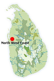
Kalpitiya Information and Google Map
PROVINCE : NORTH WESTERN PROVINCE
DISTRICT : PUTTALAM DISTRICT
POPULAR : BEACH, WIND SURFING
WEATHER : 32 °C
PHOTO GALLERY


Historical Background
The coastal towns just north of Colombo, including Negombo, Marawila, Chilaw, Kalpitiya, Puttalam and Mannar, rich with cinnamon and spices, have attracted traders since the 5th century. Many of those traders settled in the area, including the Portuguese and Dutch in more recent history.
Shopping
Those cooking independently can buy fresh seafood straight from the fishing boats as they come ashore in the mornings. Negombo’s fish auction at the harbour is also worth a look. Negombo, Kalpitiya and Mannar have a few grocery stores, pharmacies and banks.
Events
From December to April, hundreds of dolphins can be seen off the shores of Kalpitiya. The giant blue whale is another occasional visitor. Migrant birding season in Mannar is from October to March when flamingos and other water birds in their hundreds line the lagoons and waterways. In August each year a colourful perehara, including fire walking, takes place in Chilaw, organised by the Munneswaram Kovil.
Climate
Negombo follows the weather patterns of Colombo, only 20 miles to the south, and has its best weather between December and April, also being affected by the south-west monsoon which brings rain from May to July. By the time you travel up the north-west coast as Mannar, however, the picture is much more different: a dryer landscape for much of the year with the bulk of the rain falling from October to December – a weather pattern typical of the north-east monsoon. There is also an inter-monsoonal period of unsettled weather in October.
Sights
Old fishing crafts such as the 'oruwa' or catamaran with its bellowing sails, are used by Negombo’s fisherman and is characteristic to this part of the island. The majestic view of the catamarans as it sets sails into the sunset is a wonderful sight. The deep sea off the Gulf of Mannar in Kalpitiya is home to dolphins, whales, stingrays and several species of Marine turtles. Watersports are also available here. Sri Lanka’s largest salt-water wetlands, the Muthurajawella marshes, lie south of the Negombo lagoon. A century’s old network of canals, linking Colombo’s seaport to Negombo, still function as active waterways and can be explored by boat, or by cycling or walking along sections of the path.
North east of Puttalam is the beautiful Wilpattu National Park, with a chance to see leopards, elephants, sloth bear, water buffalo, deer and many birds. Covering an area of 131,000 hectares from the Northwestern coast to the north-central province, Wilpattu is one of Sri Lanka’s oldest wildlife parks. Situated away from the common tourist routs, Wilpattu is unspoilt and can be enjoyed in tranquil seclusion. What it may lack in animal stocks it makes up for in tranquillity.
Bird watching is rewarding in Mannar during the migrant season when flamingos and numerous other birds line the lagoons and waterways. The Giants' Tank, constructed more than 1,500 years old, is also popular for boating and fishing. Adam's Bridge is a 30km expanse of 18 sand banks which connect the island of Sri Lanka to India; part of the legend of Ramayana. Just as the sandbanks link India to Mannar Island, a causeway links Mannar Island to the Sri Lankan mainland. Arippu Fort was built by the Portuguese in the 17C, whilst the ruins of Doric House date back to the first British Governor of Ceylon, Sir Frederick North.